SOURCE: TIMES NOW
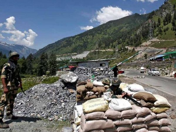
As the latest rounds of talks between military commanders of India and China at the Line of Actual Control (LAC) have shown, there’s no solution in sight – following the Chinese army’s intrusions this year – and there is unlikely to be one, unless we get real about what could be acceptable to China, more so if a wider conflict is to be prevented, even though the Chief of Defence Staff has assured us that India’s forces are prepared for it.
But before we look at another conflict in the Himalayas, or worse still beyond that, it would do us well to understand what China is willing to accept. Beijing had asserted on September 29 that it could abide by a Line of Actual Control based on the boundary proposal of 1959.
This was first proposed by Mao Tse Tung’s premier, Chou en Lai, to India’s Prime Minister Pandit Jawaharlal Nehru, on 7 November 1959. But the LAC apart, the other half of the Sino-Indian boundary runs along the northern reaches of Arunachal Pradesh, in the Himalayas. This is the McMahon Line, that follows a watershed principle, and it was the positive outcome of the Simla Conference. It came about after nine months of negotiations between the representatives of the British government in India, and the governments of Tibet and China, from October 1913 to July 1914, as explained in great detail by General JJ Singh in his book titled, “The McMahon Line: A century of discord”.
China, it appears, could be willing to accept the McMahon Line – that runs from the northeast corner of Bhutan to the Tibet-India-Myanmar tri-junction – as a border. In the past, China had agreed to the principle about not disturbing population settlements (as in Arunachal Pradesh), if India would be willing to accommodate China’s claims over Aksai Chin as a swap for Arunachal Pradesh. India had rejected this idea, during Pandit Nehru’s time, and then – according to informed insiders – in Indira Gandhi’s time, when Nehru loyalists felt they shouldn’t betray his legacy! And even when the LAC was finally adopted in 1993, India had insisted that it mustn’t be defined as per China’s 1959 claim line. But it could be a way out of the current ‘no war, no peace’ scenario, as China will not withdraw from Aksai Chin, whatever the assertions by India’s political leaders. It has many strategic reasons to hold on to that area; from the water sources of the Indus to the minerals there – including Uranium – and for a possible land route to the POK and CPEC. And while India’s claims – given below – are backed by maps, China’s claims are based on its land grab!
To understand the different claim lines, some historical hindsight will help. India’s claims over Aksai Chin, as a part of Ladakh, are based on lines drawn on maps from time to time, to indicate the extent of the British Empire in the Indian sub-continent. These have been explained in detail by Alok Bansal in a book edited by Shakti Sinha, titled: “One Mountain Two Tigers.” Until 1947, three lines on maps had defined the boundaries of Ladakh. These were the Johnson Line (of 1865), the Johnson-Ardagh Line (of 1897) and the Macartney-Macdonald Line (of 1899). Thus, since 1947, the Government of India has regarded, the Johnson-Ardagh Line as its official boundary, though it has done little to enforce that claim. It was assumed that in 1949, when the Mao’s PRC (People’s Republic of China) came into being, China would settle for a boundary- ie, the British government’s Macartney-Macdonald Line – which existed then, as indicated on the map attached with this article. But it refused to formally acknowledge that.
India’s claim was largely around the Johnson Line, that came into being a decade after the British had begun the Great Trigonometric Survey of India in 1855. The survey of the north-east corner of Ladakh, and the route from Leh to the Karakoram Pass, was entrusted to WH Johnson, who was encouraged by the then Maharaja of Jammu and Kashmir, Gulab Singh, to show the northeastern reaches of his kingdom well beyond the Karakoram Pass. Johnson had a grievance against the British for him being socially slighted for his Anglo-Indian lineage, and so apparently took the Maharaja’s line. As there was already a fort at Shahidulla, where the Maharaja’s troops and officials were stationed from 1863, Johnson’s Line had included all these territories between the Karakoram Pass and the Kunlun mountains.
The British were unhappy with the ‘line’ demarcated by Johnson, but as the Chinese writ then didn’t run as far as these areas it was apparently never presented to China. When the Maharaja’s soldiers vacated these inhospitable areas by 1866, the Chinese took control of Shahidulla. But as the British government was acutely concerned with the possibility of the Russian Empire extending its footprint onto Tibet and east Ladakh, the British decided to modify the Johnson Line — along the crest of the Kunlun mountains, north of the Yarkand River — to limit Russia’s reach. And so, in 1897, Major General Sir John Ardagh, the then Director of Military Intelligence in Delhi, marked out what came to be known as the “Johnson-Ardagh Line”. Since India’s independence, even though the boundary in the Aksai Chin sector is described as ‘un-demarcated’, New Delhi’s have been based on this line.
There was also another line that was used in British maps of the region, that London referred to until 1908, i.e, the Macartney-MacDonald Line. As London was sometimes at odds with the strategic views of their officers in Delhi, in those days, George Macartney, London’s consul general in Kashgar (in Sinkiang, now called Xinxiang), proposed a border along the Karakoram mountains, aimed to limit any Russian advances into Tibet. And as the Postal Atlas of China, published by Peking from 1917 to 1933, had shown the boundary of Aksai Chin with Tibet along the Johnson Line – that runs along the Kunlun mountains – it was assumed that when the PRC (the People’s Republic of China) was founded in 1949, that they’d opt for the Macartney-MacDonald Line, as their boundary. But they didn’t. This was the start of the new Chinese claims over Aksai Chin and Ladakh, leading to the 1962 Sino Indian conflict, when Pandit Nehru’s government refused to discuss China’s claims, first based on their 1959 claims and then the 1960 claim line.
However, the boundary dispute with China is not just about the LAC, east of Ladakh, but also along the Himalayan crest on India’s north east, along the McMahon Line. Peking (now Beijing) had in 1960 suggested the withdrawal of troops by both armies to 20km from the McMahon Line. Even then, the Chinese have been open to accepting that line as a boundary, give or take a little, even though Lt Col Henry McMahon was unable to convince the Chinese representative at the Simla Conference, in 1914, to accept his proposals. But as he wasn’t allowed by his leaders in Peking to do so, he drew a line that marked out India’s northeast frontier that came to be known as the McMahon Line (and one that India has steadfastly maintained is its border with China, since the 1950s).
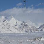
The central question now is, ‘could there be a settlement over China’s 1959 proposed line – that could give Aksai Chin to China, while recognising the McMahon Line, by which India keeps Arunachal Pradesh – or whether for reasons of national pride we will continue to remain in a constant state of high vigil, with soldiers deployed at over 15,000 feet in physically demanding conditions with no end in sight?’ Our soldiers have been deployed at the Siachin glacier for 35 years and it still remains ‘un-demarcated’. Left to South Block, we could be staring at another three decades here, making it a century of boundary disputes not just with China, but also on the LoC with Pakistan!