SOURCE: Times Now Digital
In what proves India’s argument that it has abided by the binding principles along the Line of Actual Control (LAC), satellite images have shown that the Indian Army camps are well within the Indian side of the LAC.
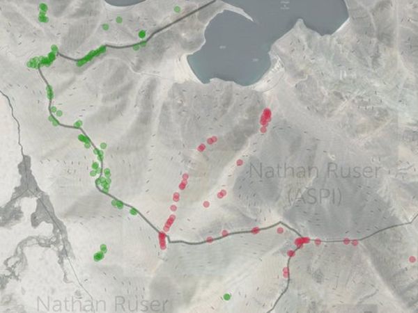
Nathan Ruser, a researcher with ASPI’s International Cyber Policy Centre has shared satellite images indicating Indian and Chinese forces along the South bank of Pangong Tso on September 7. “Chinese positions dominate Black Top and Helmet Top heights, no suggestion of Indian positions there, they have built-up at lower elevations,” Ruser said in a tweet on Thursday.
“At no point has India crossed their interpretation of the LAC, and they have mostly kept behind the generally recognised LAC, however, they appear to have crossed it in places to establish unmanned defensive positions, along with a road along the ridgeline,” he said in another tweet.
Images underline China’s expansionist designs
The images underline India’s stated diplomatic position and substantiate the global argument regarding Chinese expansionism. India and China are locked in a bitter standoff along the southern tip of Pangong Tso.
While China has alleged that India violated the agreements guiding the LAC and claimed that the Indian Army carried out military manoeuvres, India has vociferously refuted the Chinese stance and said that violations were unilaterally carried out by the People’s Liberation Army (PLA) troops.
While the two sides have held a series of military, as well as diplomatic engagements, they have made little progress in resolving the crisis that began in May. Defence Minister Rajnath Singh met his Chinese counterpart in Moscow, on the sidelines of the Shanghai Cooperation Organisation (SCO) a few days ago. External Affairs Minister S Jaishankar is slated to hold talks with Chinese Foreign Minister later during the day today.


