Table of Contents
SOURCE: THE PRINT
We have been surveilling the India-China Line of Actual Control or LAC in Ladakh area almost real-time since several stand-offs were reported a few weeks back, using satellite imagery. For the most part, we found not a single blade of grass amiss save for a brief Chinese encampment on the Indian side of the Galwan Valley. That intrusion was so small — around 40 to 60 Chinese troops — that it simply did not merit the kind of rhetoric and escalation that we have seen over the last fortnight.
However, the inadvertent release of an unauthenticated video (showing Indian troops allegedly attacking Chinese troops and their vehicle) and of an image (showing the Chinese allegedly having bound and apprehended Indian troops) provided us vital clues on what has been happening to justify the heightened tensions. Using these two visual sources we were able to not just triangulate the exact location of the fracas, but also the approximate dates and sequence of events.
It turns out our initial assessment of the situation — that there is no Chinese occupation of Indian territory — is quite correct. The reason the satellites did not see any “occupation” is that there was none. Instead, what has been happening is a series of fast-paced in-and-out intrusions by the forces of India and China into each other’s territory. While the gravity of China’s provocation has been much more serious, but note that India stemmed this, push the Chinese back and retaliated swiftly in order to re-establish deterrence.
Incident A: Chinese intrusion into India
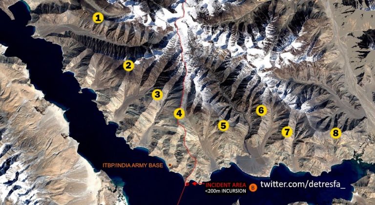
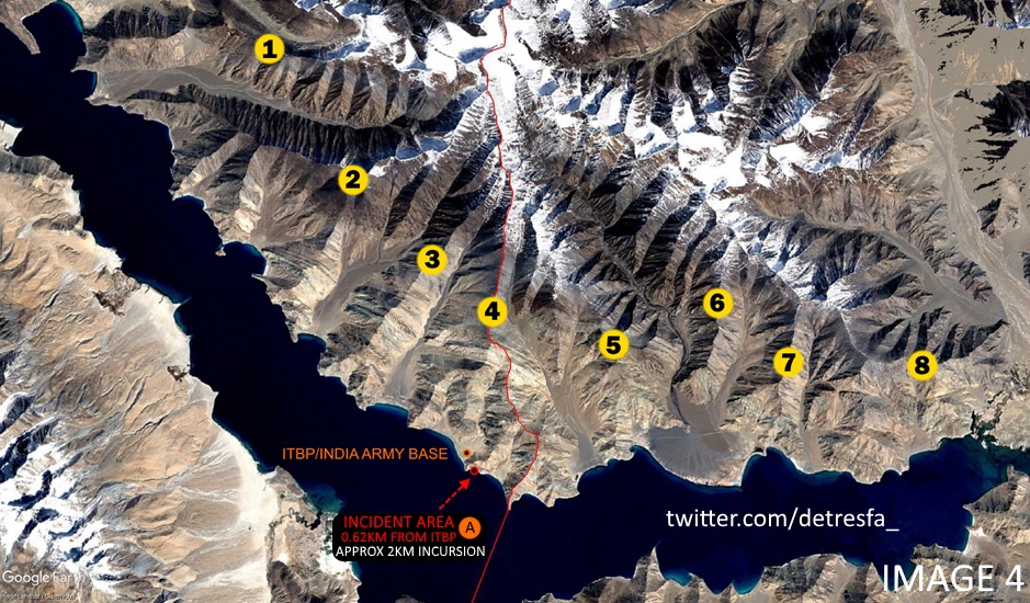
The video purportedly showing a Chinese patrol intercepted and beaten up by Indian troops is particularly illuminating. The still shot capture (Image 1) allows us to geolocate the incident (Image 2). This is almost 2 kilometres inside Indian territory (as the crow flies), as measured from the LAC close (0.62 kilometres) to the Indo-Tibetan Border Police (ITBP) camp at the base of finger 4 (Image 3).

The overall location of the incident and the Indian camp with respect to the LAC and the fingers can be seen in Image 4.
We were able to place this incident at some time between 19 and 21 May based on two other incidents. The first was a significant beefing up of the ITBP camp starting on 21 May, clearly in response to some trigger, and the second was studying the movement patterns of the Chinese vehicles involved in this incident.
The vehicle (Image 5) is a Dongfeng CSK131, a Chinese armoured four-wheel drive vehicle similar in function and style to the American Humvee. The purpose of this vehicle is high-speed reconnaissance — which is to say it does a rapid drive-through of hostile terrain. An example of such a drive-through by a similar type of vehicle was during the 2003 US invasion of Iraq when the Humvees along with tanks were the first vehicles to enter Baghdad for a rapid reconnaissance.
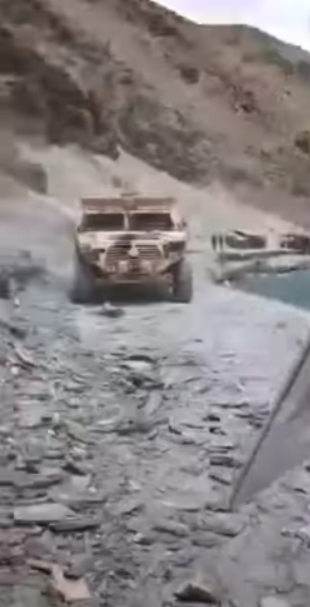
Our visual surveillance of Chinese camps in the region did show a change in the parking positions of these vehicles as well as trucks (presumably transporting the troops seen in the background in Image 5). Significantly all these vehicles seemed to have returned to their Chinese bases, with none staying on the Indian side over a 14-day period. This proves that whatever happened was momentary and was repulsed rapidly.
Incident 2: Indian troops ‘restrained’
This is where the second set of images becomes significant. Image 6 shows Indian troops (at least one quite seriously injured) being allegedly restrained by Chinese troops. This was geolocated to the west bank of Fox point, the peninsula seen in Image 7. There are two interesting features here: 1) note the face-masks on Chinese troops indicating this to be a post-Covid episode, and 2) the boat on the top left of the image, showing this incident to have been just 1-2 meters away from the waterline.

Our study of Chinese boat activity in the region, showed only one episode of Chinese boats coming so far west during the last fortnight and that was at Fox point – the southernmost peninsula on the northern bank of Pangong Tso (Image 9). Fox point – an extension of finger 4 has a high ridge running on its western periphery. This ridge marks the LAC. The boats, as can be seen in image 8, were clearly on the Chinese western side of Fox point on 22 May.
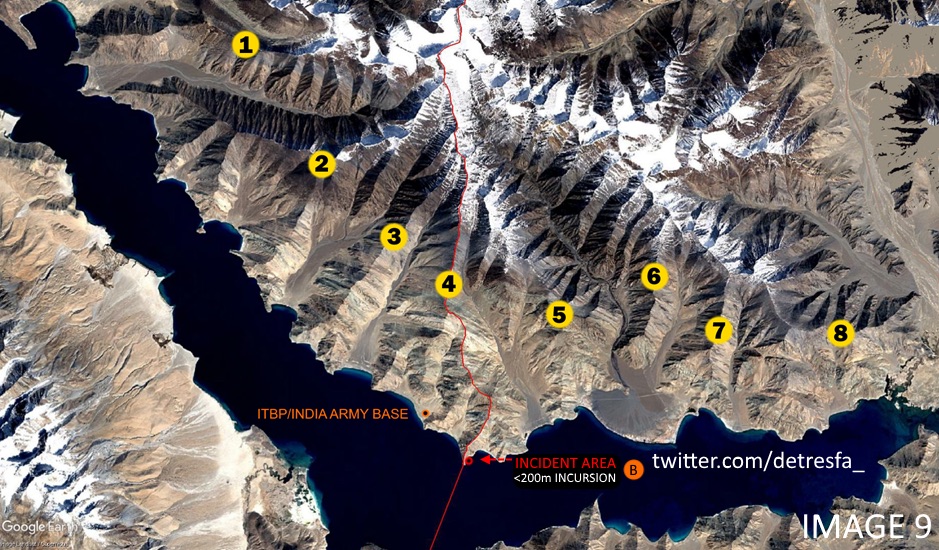
This is significant for three reasons. First, it shows considerable Indian activity west of the ITBP base, literally a day or two after the deep Chinese incursion described earlier. Second, it confirms that the Indian troops were ordered to proceed into the Chinese side of the LAC albeit not as deep as the Chinese incursion into India. Third, it confirms that by this time (22 May) there was no Chinese presence west of the LAC, putting paid to any rumours of an “occupation”. Moreover, it confirms our interpretation of Images 1 through 5, that the Chinese were doing rapid sweeps and testing Indian readiness in the area, not occupying it.
Testing readiness
In the following articles in this series, we will explain the situation in Galwan and the Hotsprings (Gogra). However, for now, the conclusions as far as the Pangong area is considered are clear. Combined with previous reports, there has been a systemic pattern of testing readiness across the LAC in the Pangong area. This has led to what have so far been non-lethal scuffles, but clearly deep intrusion as described by Defence Minister Rajnath Singh (note his use of past tense). However, India has not been taking this lying down and its response has been robust, albeit not as exuberant as the Chinese.
https://defencenewsofindia.com/no-chinese-occupation-geolocated-images-show-fast-in-and-out-intrusions-by-india-and-china/

